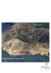
Wellington Region Landscape Atlas
Search in document library
This Wellington Region Landscape Atlas has been developed as part of the Wellington Region GIS Database made available through the Regional Council in April 2009. The GIS Database was developed in collaboration with the eight territorial authorities of the Wellington region and the adjacent regional and district authorities in the Manawatu-Wanganui region (Figure 1.).
