Why was this work done?
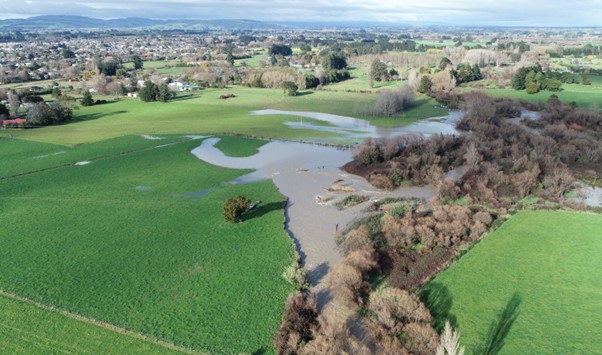
The flood risk to Carterton from the Mangatārere Stream has long been recognised. The risk is known from:
- Local knowledge and historical photos
- Visible former river channels that could carry water into Carterton
- Previous work done to estimate this hazard in the 1990s and included in the Wairarapa Combined District Plan (based on a 50-year/2% Annual Exceedance Probability, AEP1)
This risk is mainly from the stream breaking out of its channel to the north of the town.
In 2012, GW identified Carterton as being a high priority for further investigations to better understand the flood hazard.
How was the flood study area developed?
In 2014, Opus International Consultants prepared two draft reports for GW – one report on the hydrology of the Mangatārere Stream and the other on preliminary flood modelling including flood maps. This work was finalised in 20182.
The preliminary flood modelling used an estimate of the size of a 100-year/1% AEP flood. Because our climate is changing, and decisions about building houses and infrastructure have long-lasting implications, an additional allowance of 20% flow was included to account for climate change to the end of this century. This is consistent with current Regional Council policy and current guidelines from the Ministry for the Environment.
Normally, a flood hazard map would use a further allowance to account for uncertainties in the information (often called “freeboard”) however this should be done following a more detailed analysis. In this case, we wanted to define an area that is potentially subject to flooding and that requires further investigation. Because the greatest uncertainty is usually the hydrology (how much water comes down the river, and the peak flow) GW and CDC decided to add an extra 20% factor onto the preliminary flood maps in order to define the Flood Study Area. This will be replaced with a more detailed consideration of the uncertainties during the next phase.
Why are you making this information public?
The information has to date mainly been used by GW for internal purposes, including to confirm the priority for a full, detailed flood hazard assessment and to commit funding to this in GW’s Long Term Plan.
GW and CDC have legal obligations to make the public aware of any information they hold about natural hazards. Although the information is only preliminary, it is still the best information we currently have about the Mangatārere Stream flood hazard.
In using the preliminary information to define a Flood Study Area, CDC and GW have tried to achieve a balance between making sure everyone is informed about the potential hazard while still recognising the concerns that people may have about their properties being within the study area.
Releasing the information we hold is also a good starting point for involving people in a more detailed assessment of the hazard.
Is my property at risk of flooding?
We recognise people may be concerned at being identified in a flood study area, and their property potentially being subject to flooding.
The flood study area identifies the properties that are more likely to be flooded in 100-year/1% annual chance flood, including an allowance for climate change up until the end of this century. That would be a large flood and there is no record of such a large flood affecting this number of properties (although these properties tend to lie around low areas and existing streams, some of which have been subject to surface flooding). Nevertheless, it is worth considering what could happen in a large flood and what should be done to address the risk.
GW is happy to provide more detailed information about specific sites. Please contact us at info@gw.govt.nz or 0800 496 734 with details of your property, including the legal description (Lot No. and DP) if you have it.
Why is it called a flood study area?
The preliminary flood hazard mapping is only that – preliminary. CDC and GW felt that it wasn’t appropriate to use the preliminary information to define flood hazard areas, especially since the community has not yet had a chance to contribute to the process. Instead we used this information to define a flood study area that will be subject to closer investigation.
What will be done about the flood hazard?
Once we have investigated the flood hazard more thoroughly and built up a clear picture of the risk, we will discuss with the community how to manage the risk. This will be through a Floodplain Management Plan (FMP) process. There will be a range of options to consider that will likely include District Plan controls, stopbanks, channel modifications, regular operations, flood warnings, property-specific protection and others. The intention of the FMP process is to come up with the best combination of options, that provides a sustainable approach, that the community supports and can afford.
Should I tell my insurance company?
We recommend that you tell your insurance company that you’re in a flood study area. GW can provide you with more detailed site-specific information if they ask for it.
Will it go on my LIM?
CDC will note it as information on the LIM in regards to the upcoming study area with advice to seek clarification with GW on specific sites.
What does this mean if I need to get a building consent/resource consent?
You may still obtain a building consent but it may mean that proposed building work may require a higher floor level. Contact CDC directly to discuss any build plans you may have
Will this information affect my property value?
There are many places that are identified as being subject to a flood hazard. Research in overseas and in New Zealand (including the Wellington region) has not shown a link between a flood hazard area and a lowered sale price for residential property unless the house has a history of actually being flooded. Natural hazards are only one of many factors that potential buyers consider.
What happens next?
The next stage is to carry out a detailed assessment of the flood hazard, including making opportunities for the community to be involved. This is currently planned to start in late 2018.
How can I be involved?
Local people will have opportunities to be involved in the flood hazard assessment. We will be back in touch with you when we’re ready to start work on the detailed assessment and we’ll work with you on how you can provide input into the process. This will also be advertised locally. If you already have information about past flooding (including photos) then you can provide them to us now or keep them until we get back in touch. These can be provided via the GW contact details above.
Please do take photos if there is a large flood in the meantime, but only if it’s safe to do so!
1 Opus International Consultants, 2018. Mangatārere Stream Flood Modelling
Opus International Consultants, 2017. Mangatārere Stream Hydrology
2 This is the annual chance of a flood. A 1% AEP means that there is a 1 in 100 chance of a flood of this size or greater occurring in any given year. It does not mean that there is exactly one of these floods every 100 years and it is also important to remember that several big floods could happen in quick succession.


